Monitor, Analyze, Protect.
Products and Resources
CPI provides consulting and subscription-based products to simplify your GMD and GIC planning.
CPI provides consulting and subscription-based products to simplify your GMD and GIC planning.
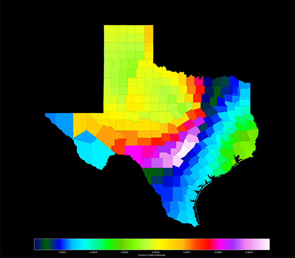
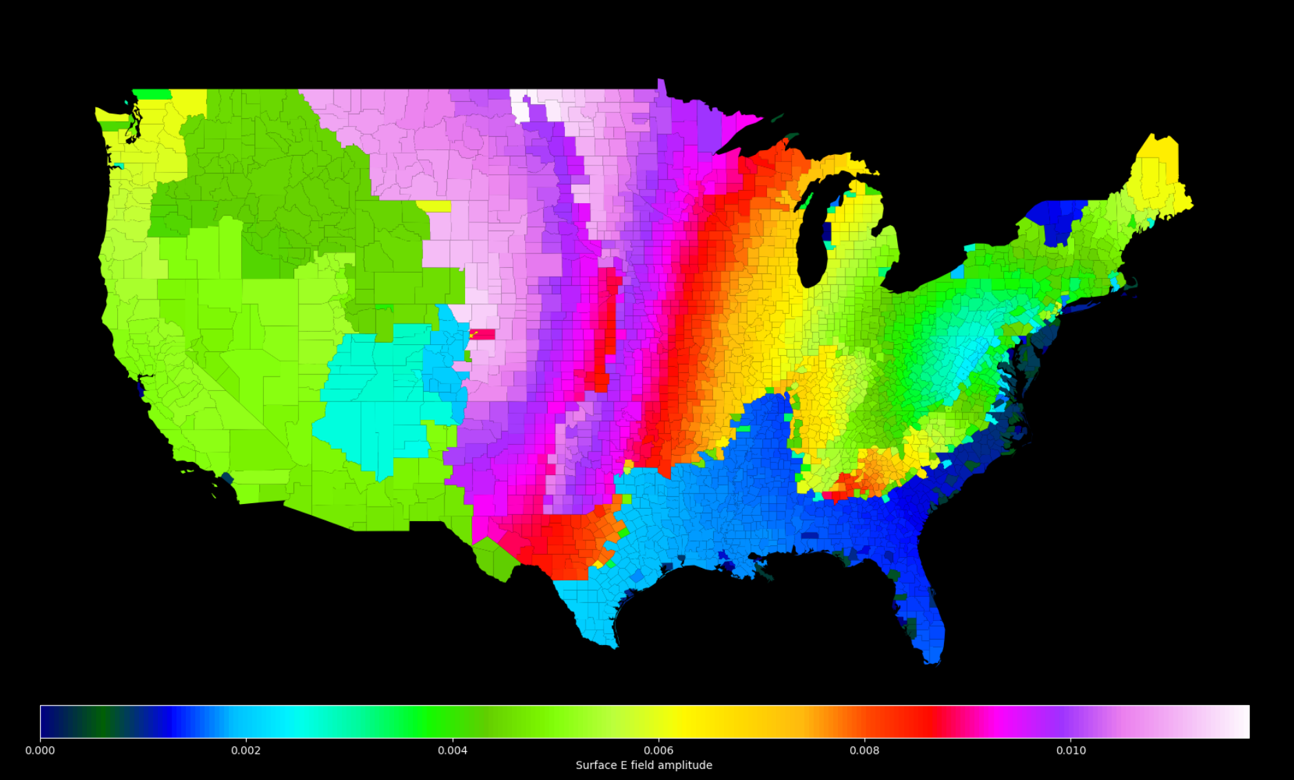
CPI's AVERT is the only available model of the geoelectric field that uses regional and local data and is customizable to customer needs.
Follow us on Twitter to get post-storm hazard information after G3 or higher events. Twitter: @CPIdata
Or join our mailing list for email updates after a geomagnetic storm.
Geomagnetic latitude is like the geographic latitude you are used to, but based on the Earth's magnetic pole instead of its rotational axis. Use this tool to find your geomagnetic latitude with a click on a map!
During a geomagnetic storm, the aurora will extend southward in geomagnetic latitude. The larger the GMD, the lower geomagnetic latitude!
Ground response models describe how a changing magnetic field relates to the induced electric field that creates the GIC hazard. These resources provide links to commonly-used ground response models.
EPRI Regional Transfer Functions (RTFs)
Earthscope Electromagnetic Transfer Functions (EMTFs)